
3 Types of Satellite Imagery
Obtaining the data as a picture through a satellite or a high-flying aircraft is known as satellite imaging or remote sensing. Many distinct satellite types scan the earth, each serving a specific function. Satellites gather electromagnetic radiation reflected from the earth using a variety of sensors to provide a satellite view of the earth. Satellite sensors can use different kinds of electromagnetic radiation (EMR), such as infrared, ultraviolet, or even microwaves.
In contrast, humans can only detect a small part of the EM spectrum (visible light). These invisible types of light are given a visible color when satellite pictures are created.
Real-time satellite imaging
Because various surfaces and objects can be distinguished based on how they respond to radiation, satellite images help distinguish objects from a considerable distance. Roads, for example, reflect almost all the energy directed at them from a particular direction. The term for this is specular reflection. Rough surfaces, like trees, on the other hand, refract energy in all directions. Diffuse refraction is the name for this. It helps to measure the quantity and density of forests and changes in the forest by detecting various kinds of reflection.
Additionally, distinct radiation wavelengths cause objects to respond in various ways. For instance, a particular frequency of infrared light can be used to assess the condition of plants. While unhealthy leaves do not represent this frequency, healthy leaves do. If you are thinking, is this how satellite views of my location are captured? Then it’s right.
Types of satellite imagery
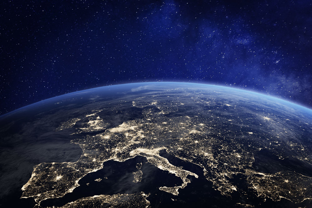
Satellite imagery is used for a wide range of purposes today, from tracking weather patterns to mapping and for warfare and defense, thanks to the hundreds of image-capturing satellites that orbit the planet and help create live satellite views of the earth. We can map and record every square mile of the planet, and these images are quickly and freely accessible via services like Google Earth. The three primary forms of satellite imaging used are:
- Visible
Visible images are what we often consider to be standard photographs. They give a relatively accurate representation of what the human eye can see. For example, when you see visible light satellite photos on Google Earth, you are viewing sunlight as it reflects off of surfaces.
Visible imaging is only useful in the daytime. The satellite cannot take pictures at night since the region has no reflected sunlight. The imagery produced by visible light has additional limitations. Sunlight is reflected differently by various objects.
The photographs show the items that reflect the least light as darker, while the images show the objects that reflect the lightest as brighter. When photographing ice with clouds, there can be some confusion. For example, it might be challenging to distinguish between cloud cover and ice or snow because they can appear similar. So, viewing a sequence of images taken at brief intervals can be helpful since clouds move, whereas snow and other frozen surfaces do not.
- Infrared
Due to the drawbacks of visual photography, infrared imaging is beneficial and can be replaced when necessary. All items warmer than absolute zero radiate energy, and infrared technology can distinguish between the different wavelengths emitted by objects of various temperatures. Since infrared photography doesn’t rely on visible or reflected light, it may be used to collect data during the day and at night.
Infrared imagery has limitations, just like visible light imagery. For instance, when used for meteorology, certain clouds and fog have temperatures comparable to the earth’s surface, making them appear to have a similar color in the photos. Infrared photography combines additional information and possibly other photos to produce an accurate, comprehensive picture.
- Water Vapor
Water vapor imagery is the least frequently used in satellite imagery. This efficiently measures the humidity level or amount of moisture in the air. It can detect moisture at different levels, from the upper troposphere to the ground. They represent the real degree of water vapor, and dry places display through different colors based on the amount of water vapor.
Suppose you get the appropriate image while searching for a satellite view of your house in a search engine. In that case, it’s because of visible light, infrared, and water vapor satellite images since they are the three principal forms employed.
Earth’s first satellite image
Explorer 6 took the first picture of earth from space in 1959. The main objective of the spacecraft was to investigate the electrical and magnetic fields in the upper atmosphere, although it also had instruments to monitor cloud cover. It took 40 minutes for the initial photograph of the Pacific Ocean to be transmitted back to a ground station in Hawaii. The resultant picture was hard to recognize when compared to present-day satellite imagery. If you have asked for a satellite view of my area, it would be next to impossible or take several days to get the image.
Final thoughts
Satellite imaging is a handy instrument in the earth sciences, particularly meteorology. It has many industrial applications and is utilized in cartography and military planning. Numerous operational telescopes transmit satellite views of the earth, and some of this information is openly accessible through websites like Google Earth and government organizations like NASA.
